Rodruin
3D FLY-OVER OF RODRUIN SURFACE SAMPLING
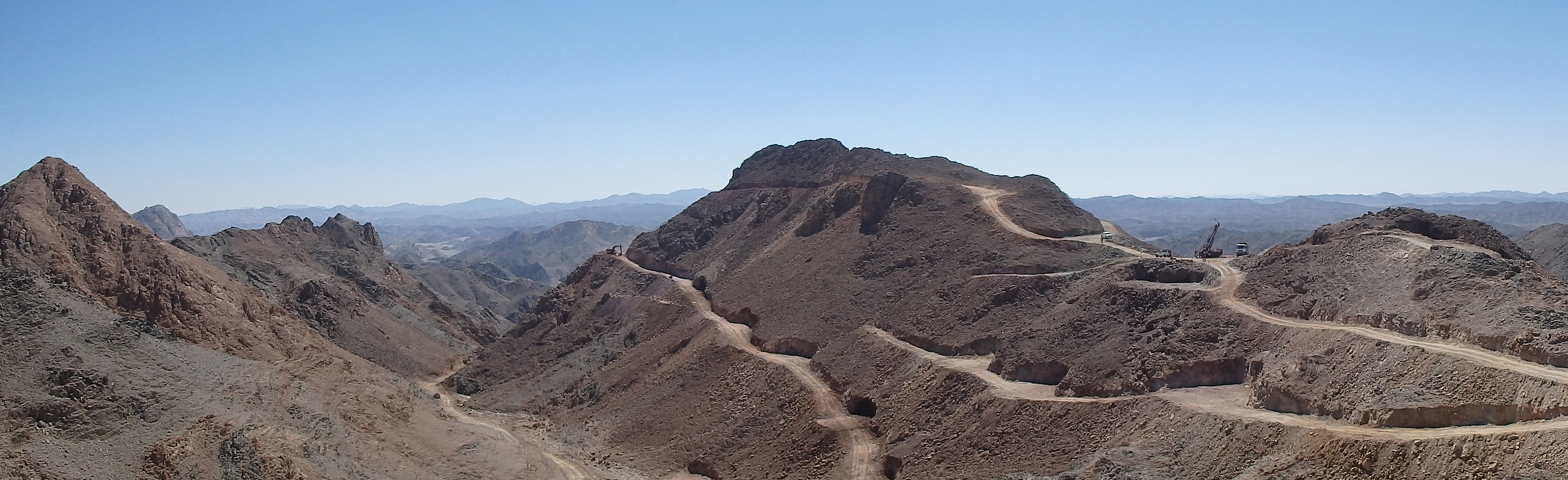
The following fly-over video was constructed from data and imagery acquired from the WorldView-3 satellite survey which was commissioned by Aton and flown in April 2018, and the resulting digital terrain model (DTM) constructed from the data. Vertical elevations are true and not exaggerated, and the video gives a good impression of the rugged nature of the topography at Rodruin. Surface sampling data is up to date to September 2018.
DESCRIPTION
The camera starts vertically above the Rodruin prospect area, showing the road layout, as constructed up to the end of September 2018, and surface samples. The red lines indicate the mineralized intervals, grading above 1 g/t Au, within the surface channel sample profiles, and the individual points are surface samples. Purple coded samples assayed greater than 5 g/t Au, and red >1 g/t Au.
The camera starts descending vertically towards the Spiral Pit and the South Ridge, before swinging NW along the ridge towards Aladdin’s Hill. Here the ancient workings are clearly visible, as is the purplish scree comprised of excavated material from the underground workings on the south side of the hill. The camera swings around to the west and then to the northern side of Aladdin’s Hill, from where one can get a good idea of the drill pad layout for the initial 3 holes drilled at Rodruin, which are visible as white points. The white cross next to the “car park” on the saddle is one of the ground control survey points that were used to georeference the satellite survey.
The camera then swings towards the SE and starts moving down the Central Valley, initially while looking south towards the scree-covered north flank of the South Ridge. High on the South Ridge the “gossan road” to the Central Buttress is visible, where good-looking mineralization has very recently been exposed and sampled in channel profile ROC-019. More very large ancient workings have been identified at the drill pad near the end of the “gossan road”.
The camera view then swings round to the north while moving down the Central Valley, looking down on the razor-sharp summit ridge of the North Ridge. A group of purple high-grade samples is visible on the northern flank of the North Ridge, one of which assayed 321 g/t Au. These samples were obtained from some significant workings perched in a very precarious location on sub-vertical outcrops. The ancients were very determined to recover their gold! The camera starts to pull back from the North Ridge and more mineralized samples from another zone of workings are visible, located high on the sub-vertical southern flank of the North Ridge below the summit edge.
As the camera pulls back from the North Ridge the view swings back around towards the NW again, and the route of the access road in from the NW is visible coming over a saddle on the far horizon, with more gossan-hosted mineralization visible in the foreground at the GF Zone. The camera continues to pull back before starting to zoom in on the Spiral Pit, on the southern side of the South Ridge, below its summit peak. As the camera zooms in on to the Spiral Pit one can see a good thickness of mineralization exposed along the side of the “southside high road” in channel profile ROC-017. This mineralization is terminated by a fault on which the high-grade Spiral Pit workings were sunk.